19 and 20 March 2014, Online
Each of the two online sessions was an hour long.
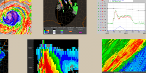
The first session (19 March) showed the meteorological processes leading to intense rainfall, such as moisture anomaly, terrain lift and instability. This was followed by information on how a forecaster can use the atmospheric indicators; radar and satellite images, and numerical models for forecasting.
The second session (20 March) focused on hHydrology. It explored the influences of intense rainfall on runoff and stream response, including soil types and land use. The flood warnings are often not of the responsibility of the weather service, but this course gave a good insight in aspects of hydrometeorology.
The course tutor was Matthew Kelsch, a hydrometeorologist from UCAR’s COMET Program. The slides were well-structured, with easy and very clear messaging. He used a lot of nice images from different COMET modules.
The software ‘GoToWebinar’ ran easily and the acoustics were perfect. It was possible to ask questions with the chat. I would have liked to receive post- course material, in form of the recording or the presentation file, for the follow-up work. But the homepage of COMET / MetEd has a link, titled Hydrology/Flooding, to 49 modules of excellent material.

